Overview:
Wentworth Shire Council has received funding from Transport for NSW to partner with Gol Gol Public School on the Active Routes to School Program.
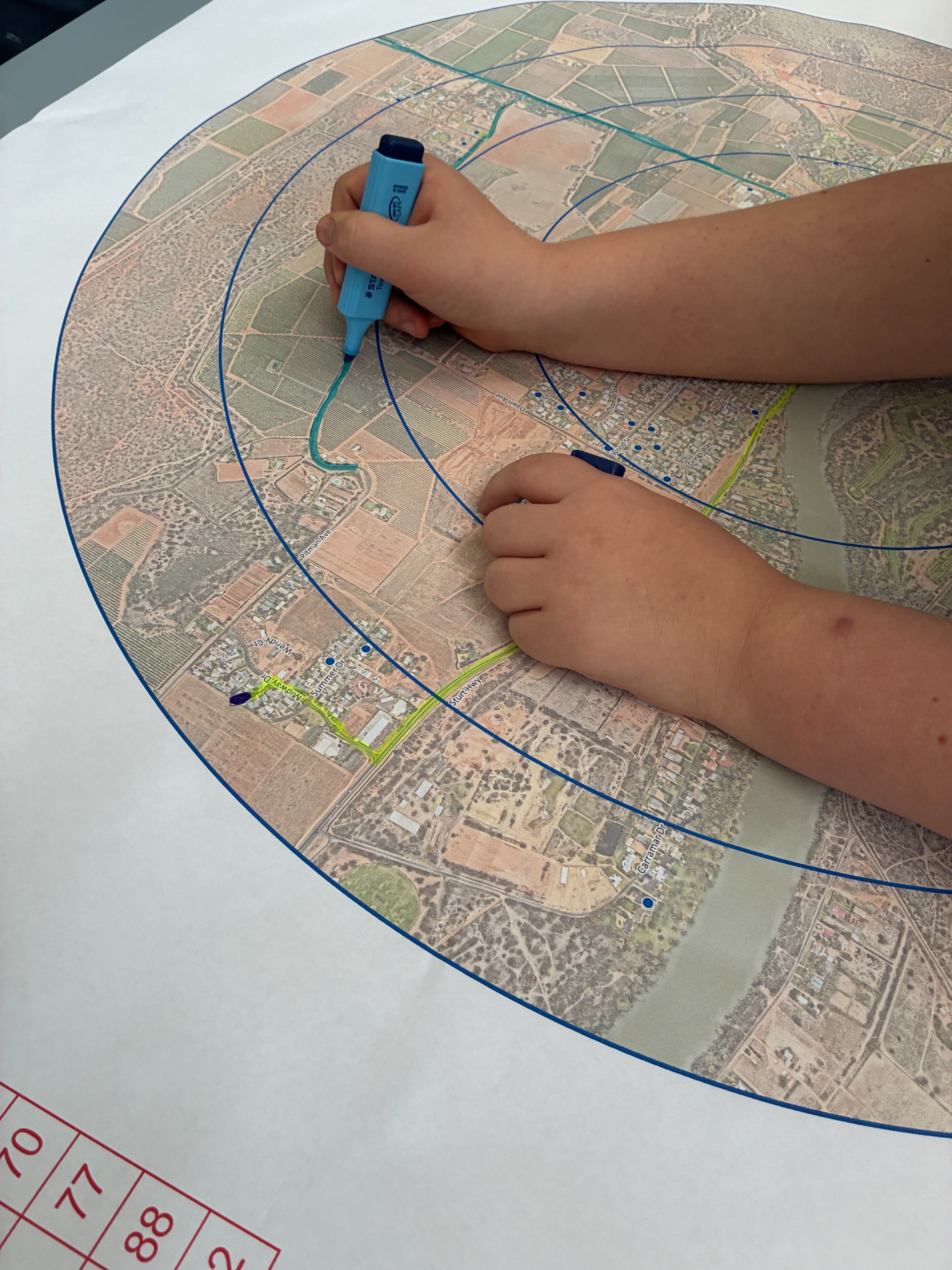
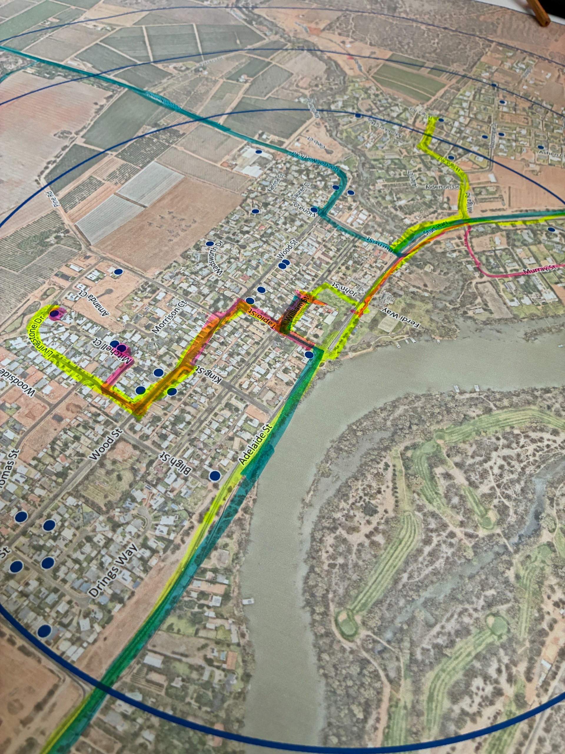
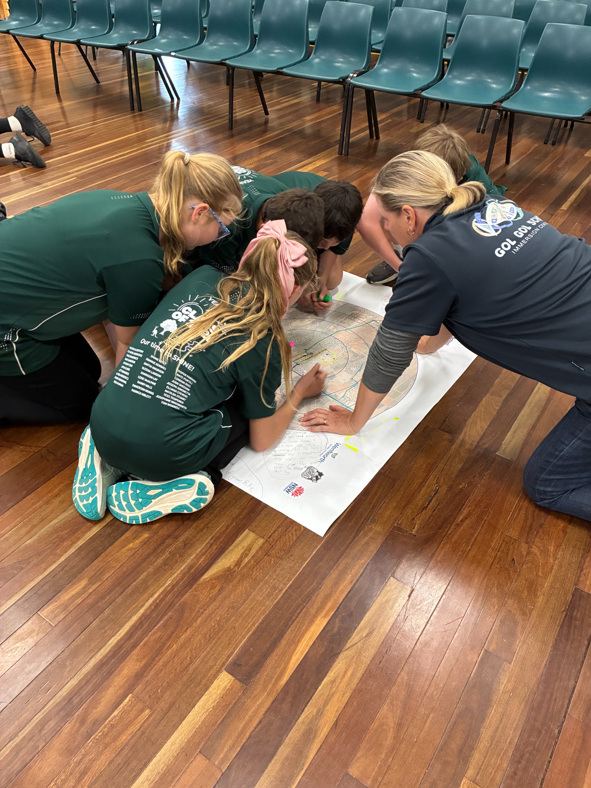
Working collaboratively, school and Council staff engaged Year 5 and 6 in a mapping exercise during their geography lessons to identify safe walking and cycling routes. This project has resulted in the designation of final walking and riding routes to Gol Gol Public School, supported by an Active Travel to School map and new wayfinding infrastructure, including footpath decals, totems, and other signage.
Project Aim:
The aim of the project is to encourage more students to actively travel to school by walking, cycling, or scootering. This shift will help reduce local traffic congestion, improve road safety, and deliver environmental and health benefits for students, their families, and the wider community.
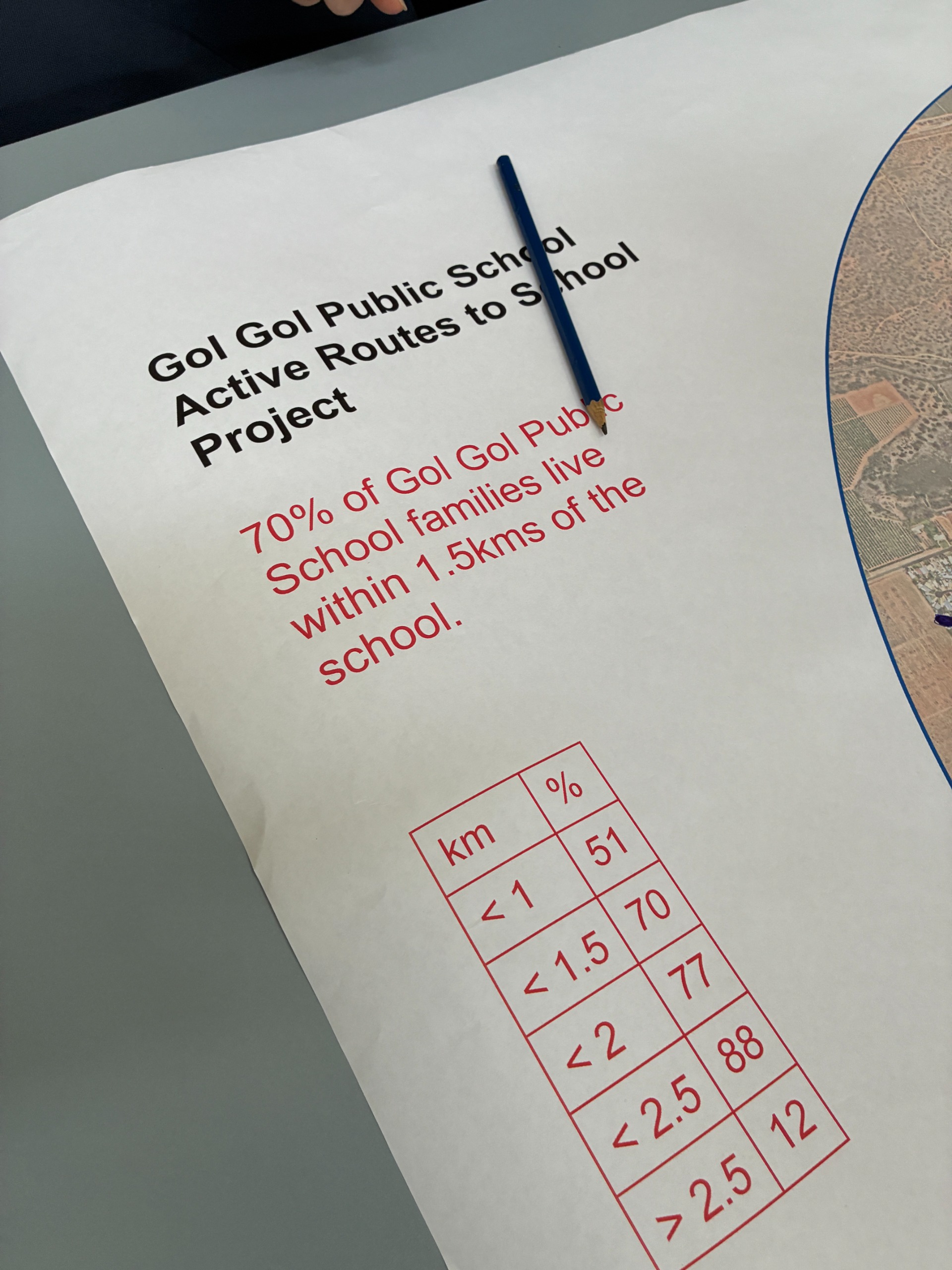
Many students live within 1.5 kilometres of their local public school, which is typically no more than a 20-minute walk away. Increasing active travel rates will help alleviate congestion around schools during peak times and significantly improve pedestrian safety.
Project Objectives:
- Increase children’s physical activity
- Improve safety around the school and complement road safety education
- Reduce car dependence
- Identify safe walking and riding routes
- Equip children with the skills to navigate their neighbourhood and assist in the transition to new high school travel patterns
About the initiative:
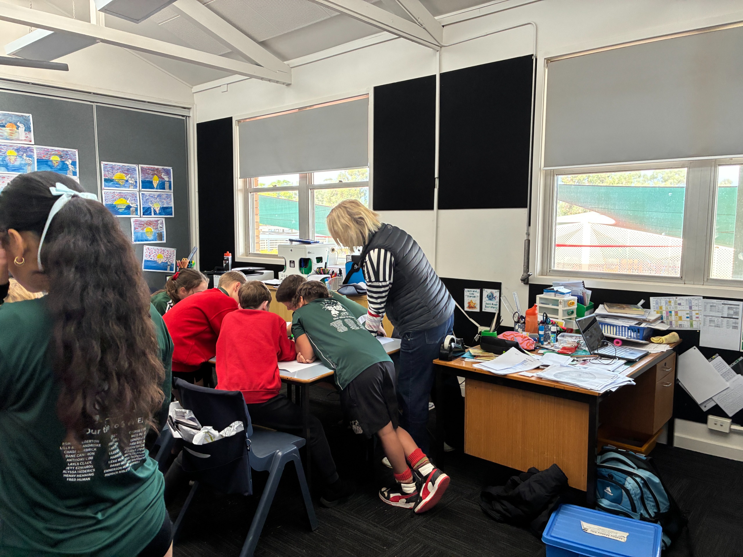
Year 5 and 6 students at Gol Gol Public School participated in three one-hour classroom lessons delivered by school teachers and Wentworth Shire Council staff. These sessions provided a range of educational outcomes and community benefits, including:
- Curriculum Alignment: Meeting the NSW Curriculum standards across Geography, Mathematics, and Personal Development, Health and Physical Education.
- Cultural & Safety Education: The inclusion of Aboriginal knowledge alongside practical road safety education.
- Skill Development: Fostering critical thinking, mapping, and spatial awareness skills.
- Real-World Application: Providing opportunities to identify and map real-world travel routes. These suggestions will be transformed into GIS maps by Council officers and shared with the wider school community.
- Community Impact: Empowering students to create tangible neighbourhood change through Council-led line marking and wayfinding improvements along their proposed routes.
Project Status & Next Steps
-
Timeline item 1 - complete
Lesson Delivery
Year 5 and 6 students participated in three curriculum-based geography lessons delivered by teachers & Council staff.
-
Timeline item 2 - complete
Route Mapping
Using large maps provided by Council, students marked out suggested walking and riding routes to school using existing paths and pedestrian crossings.
-
Timeline item 3 - active
Community Consultation (Have Your Say)
Council is inviting feedback from the Gol Gol community, and in particular parents of children attending Gol Gol Public School, regarding transport and travel within the area. Feedback is open until 14 July 2026.
-
Timeline item 4 - active
Route Review & Safety Checks
Council is currently reviewing the students’ suggestions to identify three to five recommended routes, and is undertaking a pedestrian safety check for each route.
-
Timeline item 5 - incomplete
Infrastructure & Wayfinding
Council will confirm the final routes, undertake any necessary minor pedestrian or cycling infrastructure improvements along the way, prepare a school “active map” and install wayfinding decals or stencils along each route.
-
Timeline item 6 - incomplete
Official Launch
The school and Council will organise an official launch of the active map and stencilled routes.